P05 - The architecture of the forest floor and consequences for connectivity
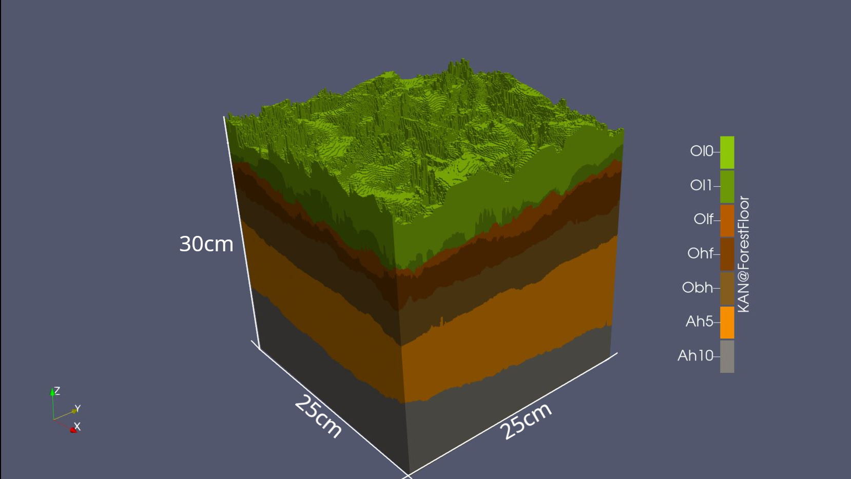
The aim of the project is to investigate the effects of climate change on the forest soil and its water balance and to develop a new method using photogrammetry to model the structure of the soil in detail in a 2.5D representation. The storage and flux of carbon dioxide and water with dissolved nutrients should also be included in the model and thus be easier to analyse. The main objective of modelling the structure of the different soil layers is to gain a better understanding of the distribution of water, nutrients and carbon dioxide in the forest soil.
Photogrammetry is a technology used to create models of objects or environments by analysing photographs. It involves taking photographs of the object, here soil, from different angles and perspectives and processing them with the help of special software and algorithms.
To measure the availability of nutrients in the different soil layers, redox plates are used. These plates are inserted into the soil and monitor oxygen availability at different depths. This will improve the understanding of nutrient distribution and movement in the forest ecosystem.
By attempting to analyse the forest soil in a new way, a new method for effective forest management can be created. Modelling the structure of the soil, with the further incorporation of other research results, can also contribute to a fundamental understanding of the influence of climate change on the forest ecosystem and the distribution of water, nutrients and carbon dioxide in the forest soil in the future, and to more forward-looking action for the future.
Overall, the project can help improve forest management and protection and support climate change mitigation.

Photometric imaging of a humus and soil monolithe form the site Kandel, Humus form typical Moder (German soil mapping guideline KA6). Each layer could depicted individually, or like in this picture as a whole humus profile. (O: Organic Horizons according German soil mapping guideline KA6, A: Mineral soil 0-5 and 5-10 cm)
| Duration |
Sep 2022 - Aug 2026 |
|
| Institution: |
Universtity of Freiburg Chair of Soil Ecology |
|
| Projekt Investigator: | PD Dr. Helmer Schack-Kirchner | |
| Phd candidate: | M. Sc. Jonas Hahn | |
| contact | jonas.hahn(a)bodenkunde.uni-freiburg.de |

